This site was located on the west bank facing the villages of Kajifarai (Kajifarre) and Amtukai (Amtukke). This stretch of the river bank was uninhabited in modern times with rocky outcrops rising to c.35m above the river, partly masked by blown sand, with very little alluvial land beyond the river bank. The ‘site’ comprised a large stone-built enclosure – of uncertain date – running along the river, c.570m long and 100-150m wide. This enclosed a rocky area with lower, generally sand-filled areas between them, sloping down to the river bank. Within the southern part of this larger enclosure a smaller wall enclosed a mudbrick building, with the remains of at least five ‘rooms’ and two lengths of stone (terrace?) walls surviving. The largest surviving room (1.1) measured c.5m x 3m internally. Much of the floor surfaces were covered with deposits of ash, and internal features included a brick bin, a possible overn (?) and several pot-hearths buried in the floors. The site was excavated by Hans-Ake Nordström in January 1965. A brief description was published in 1966 (Mills and Nordström 1966: 12-13, Fig.4).
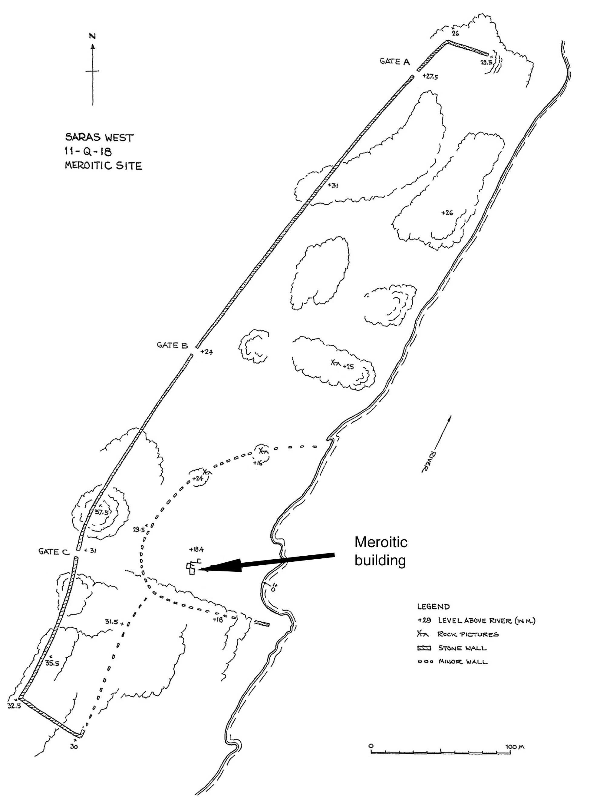
Plan of large enclosure (of uncertain date) and location of Meroitic building.
Few finds were recovered from the site, but the little pottery pointed to the site being of early Meroitic date. Several mud loomweights were also found – not uncommon finds in Meroitic settlements. No clear evidence was found to confirm the date of the larger enclosure; amongst the little pottery recovered were both late prehistoric and post-medieval sherds. Several similar enclosures are known from the region – that some/all may in fact be of 19th century (Mahdiyya) date seems possible.
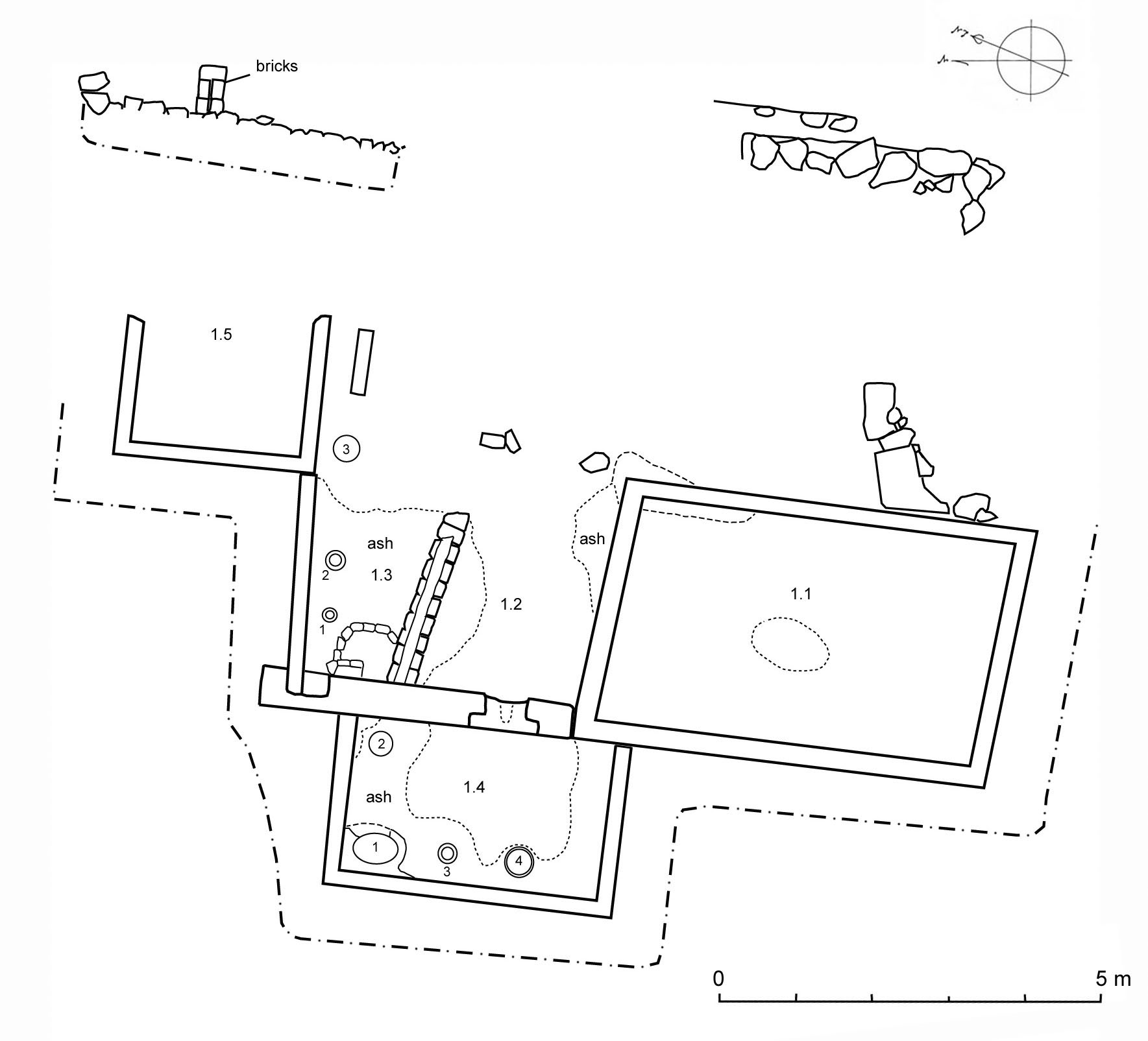
Plan of poorly preserved Meroitic building [11-Q-18].
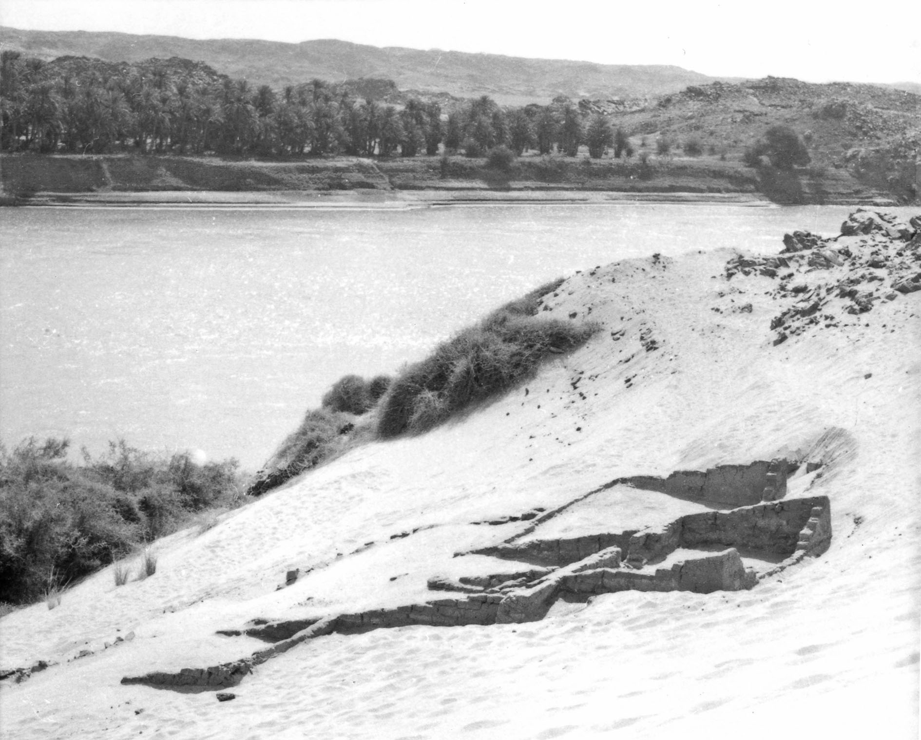
View over building remains on sloping ground – hills of Saras East across river.

Meroitic handmade jar and most of decorated wheelmade jar – both used as pot hearths
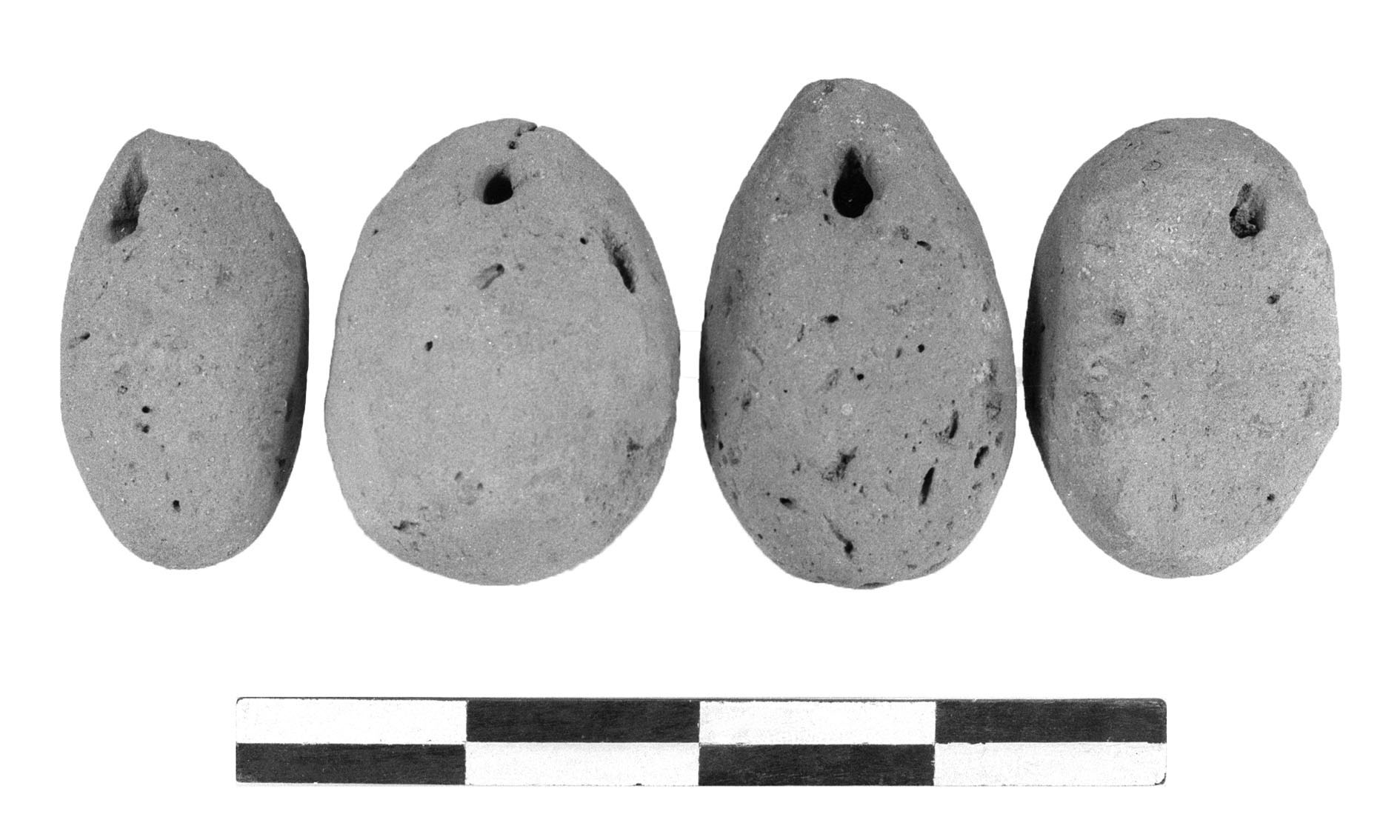
Meroitic loomweights from sandy fill of building.
