The island of Tila was c.1800m long and no more than 450m wide (an area of c.30ha). Its west side and the west bank of the river facing it was steep and rocky. The west bank of the river appears to have been uninhabited in recent centuries. The channel between the island and west bank narrowed to less than 100m in places. On the other side of the island, the east bank lay c.250-300m away, with some small rocky islands creating a number of channels. Access to the island by boat seems likely to have been on its east side, in the sandy embayment below the House II complex part of the Meroitic settlement. By the 1950s, when aerial photographs were taken of this area, there was a small group of (abandoned) houses at the north end of the island. These seem likely to relate to a relatively recent (nineteenth-early twentieth century?) occupation of the island, although there was clearly some medieval settlement on the island.
The Meroitic settlement lay on the southeast side of a large red granite hill which dominated the island. The island heights and part of the settlement were enclosed by a substantial rough stone wall 1-1.5m wide. This was preserved in places up to 1.8m high and may have stood 2-2.5m high originally. The enclosed area would have been no more than 2.5ha, altough its relationsip to the Meroitic settlement remained uncertain.
The settlement was quite dispersed, with up to ten houses or house complexes scattered over c.2.25 hectares, sited on areas of level ground among rocky outcrops. Surface sherds included medieval (Christian) date material. This medieval occupation was first noted during the reconnaissance survey which passed this area in February 1964. It was ony when the island was revisited in mid-November 1966 that the presence of Meroitic buildings was recognized and excavations began. The scale of the site then became apparent, necessitating a larger scale excavation in 1967-1968.
House III was the most southerly of the identified structures, with the small Meroitic cemetery area (16-J-19) on slightly higher ground to the southwest. This building was on a similar alignment (near north-south) to Houses VI and VII, closeby to the north, as well as House I. It was excavated by A. J. Mills during the first phase of fieldwork in November 1966. Much less well preserved and with very few finds, its excavation was completed within a week. Some further notes on the architecture of the house were made by J.E. Knudstad in 1968. The core mudbrick structure measured c.13m x c.15m with an additional platform/yard area, c.7m wide, on its south side.

The ‘House II’ complex included up to nine adjacent houses/room complexes arranged around a narrow street or alley which ran up the alluvial slope on a northwest-southeast alignment. The drop in ground levels from south to north was c.6.5m over c.50m necessitating the terracing of some houses. Excavation of this area began during November 1966 but was not completed until 1968, by J. E. Knudstad.

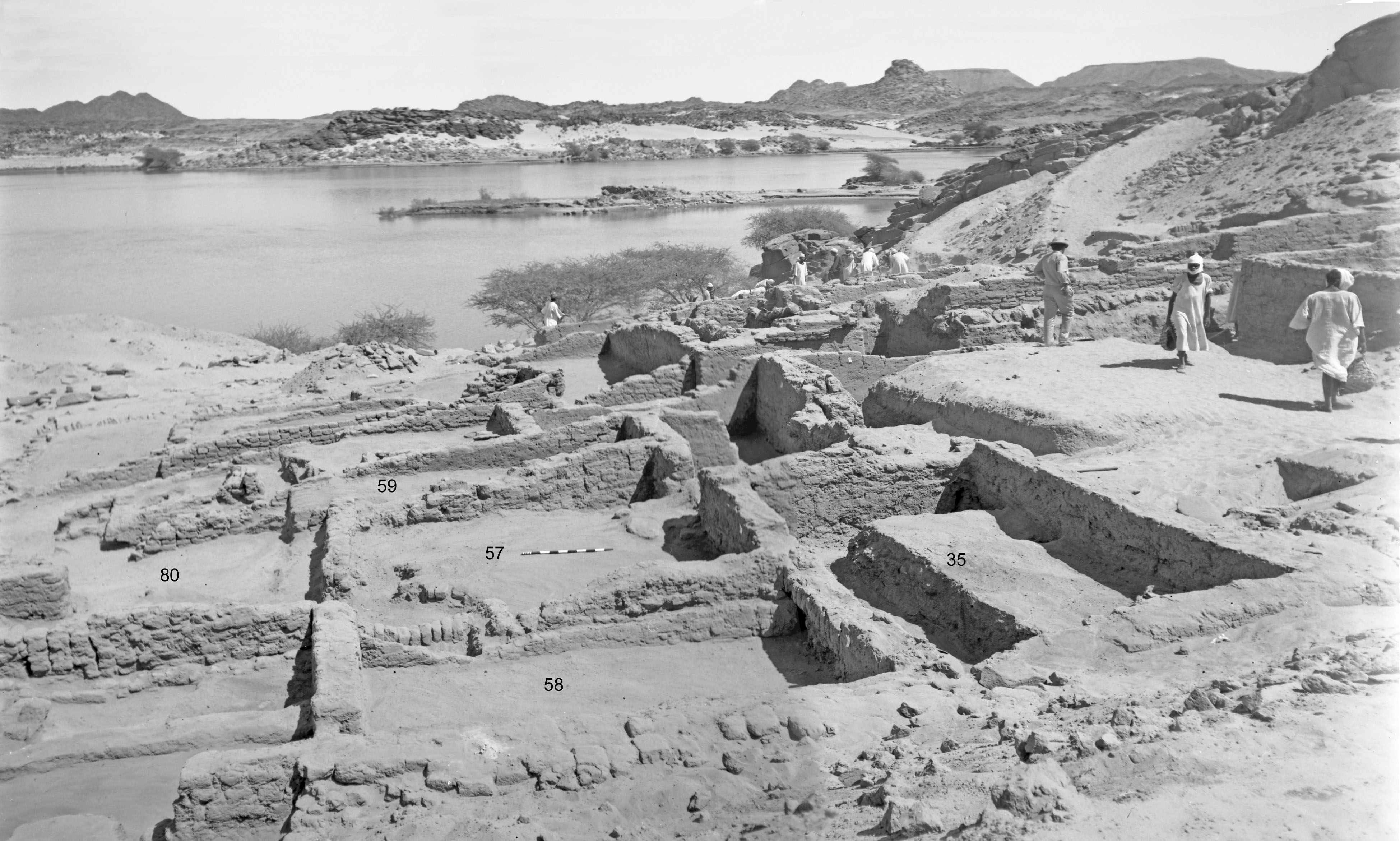
View across central area of House II complex, with river and east bank behind.

House II complex under excavation, 1968.

House II complex with with central lane running between buildings. Fireplace and storage pots set in the floors were quite common.
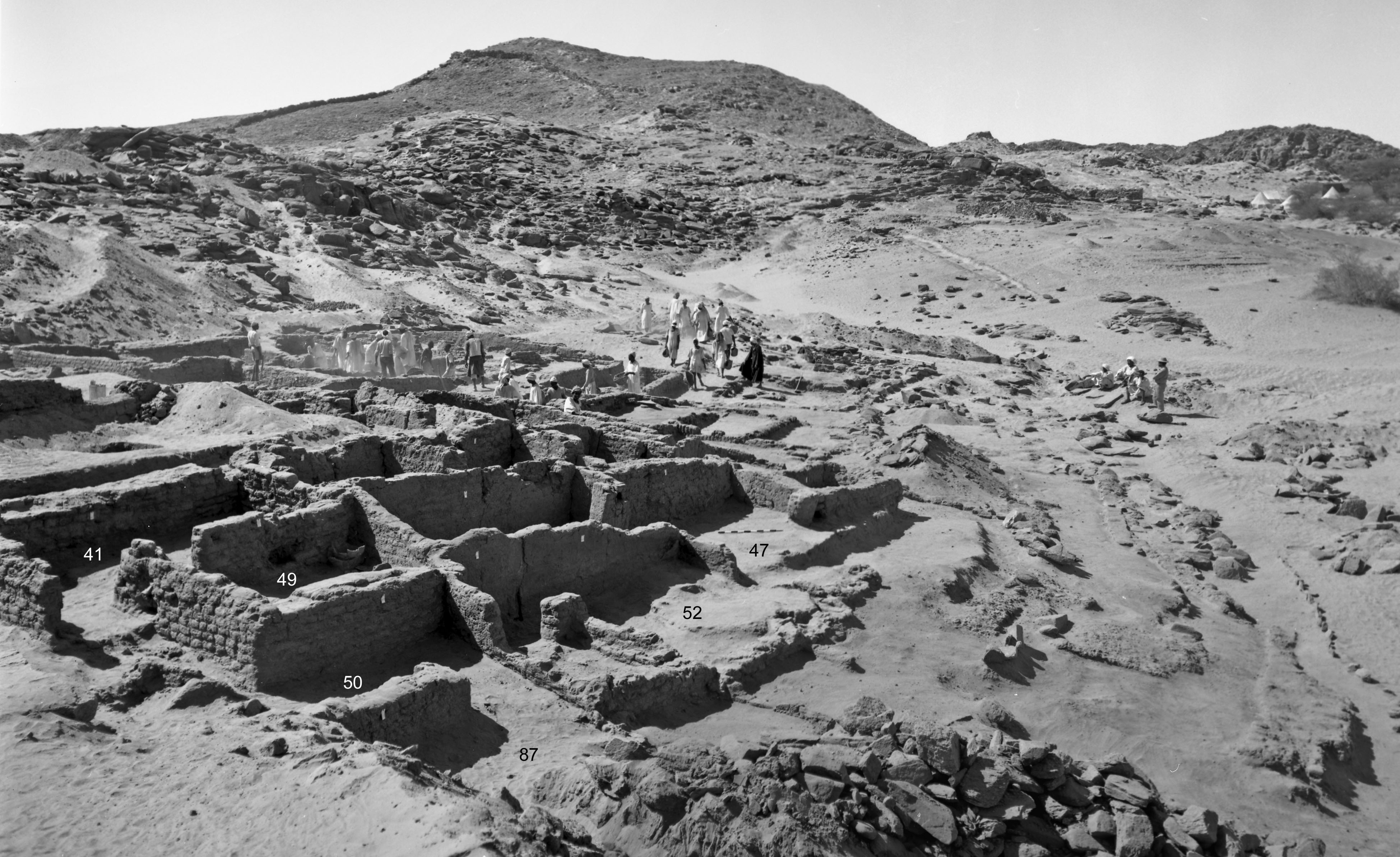
House II complex under excavation (1968), from northwest. Enclosure wall visible in distance running up hillside. Tents of excavators camp visible, top right.

Selection of registered finds (now in Sudan National Museum) from House IIB. These included several imported ‘frog’ lamps, bone tools (for weaving?), part of a lock mechanism, stamped mud sealings and Meroitic ostraca.
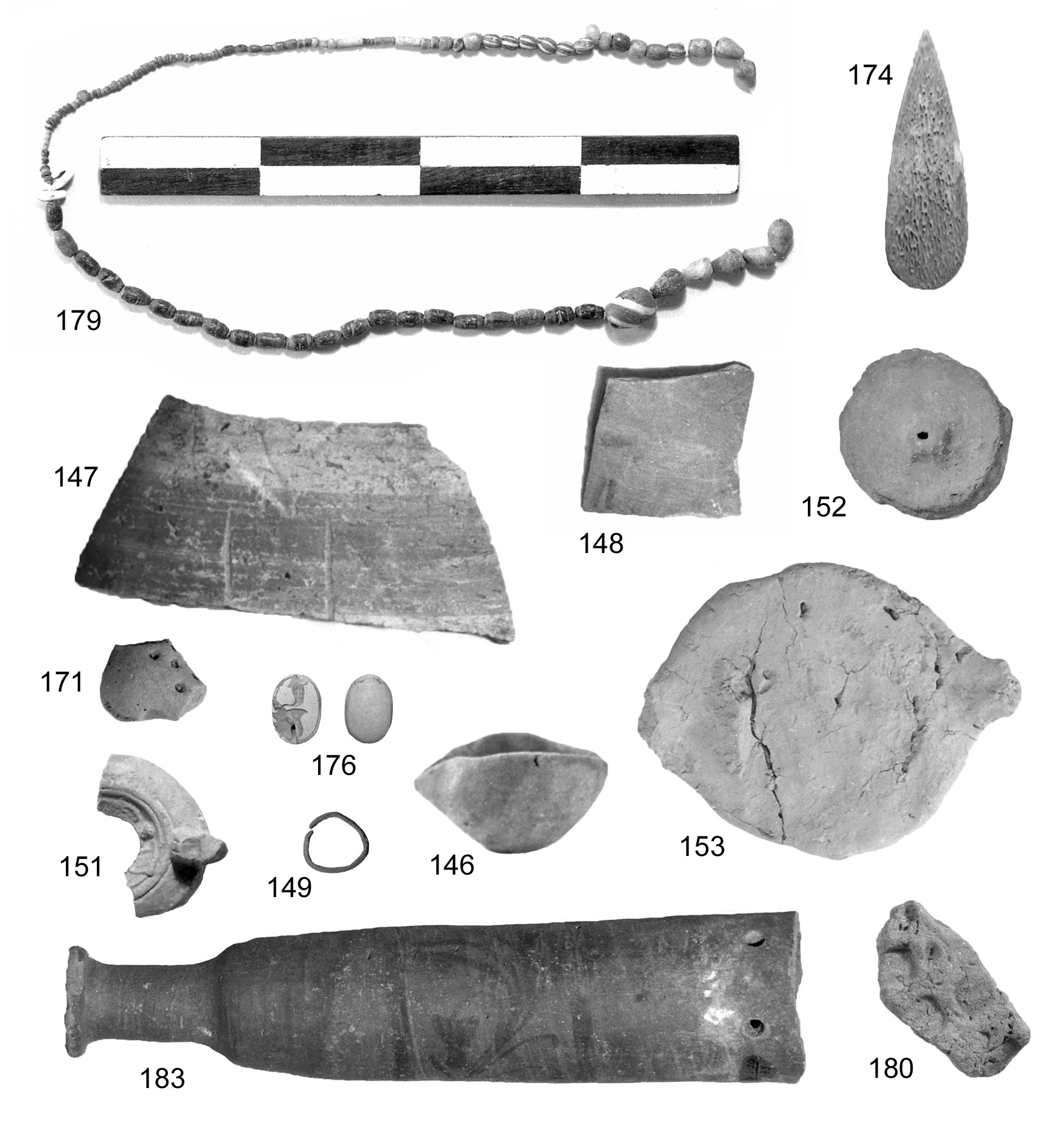
Registered finds from eastern part of House II complex, including mud sealings, an imported lamp, ascarab, bone tools, a ‘klepsydra’.
